
Nagarahole National Park Booking Portal
Your gateway to an unforgettable wildlife experience.
Discover Nagarahole National Park: Your Gateway to Wildlife
Nagarahole National Park, also historically known as Rajiv Gandhi National Park, derives its name from the serpentine flow of the 'Nagarahole' River through its lush, tropical woodlands. In the local Kannada language, 'Nagara' translates to 'Serpent' and 'Hole' to 'River'. This captivating natural haven is nestled within the Kodagu and Mysore districts of Karnataka, a vibrant state in Southern India.
Wildlife Encounters in Nagarahole
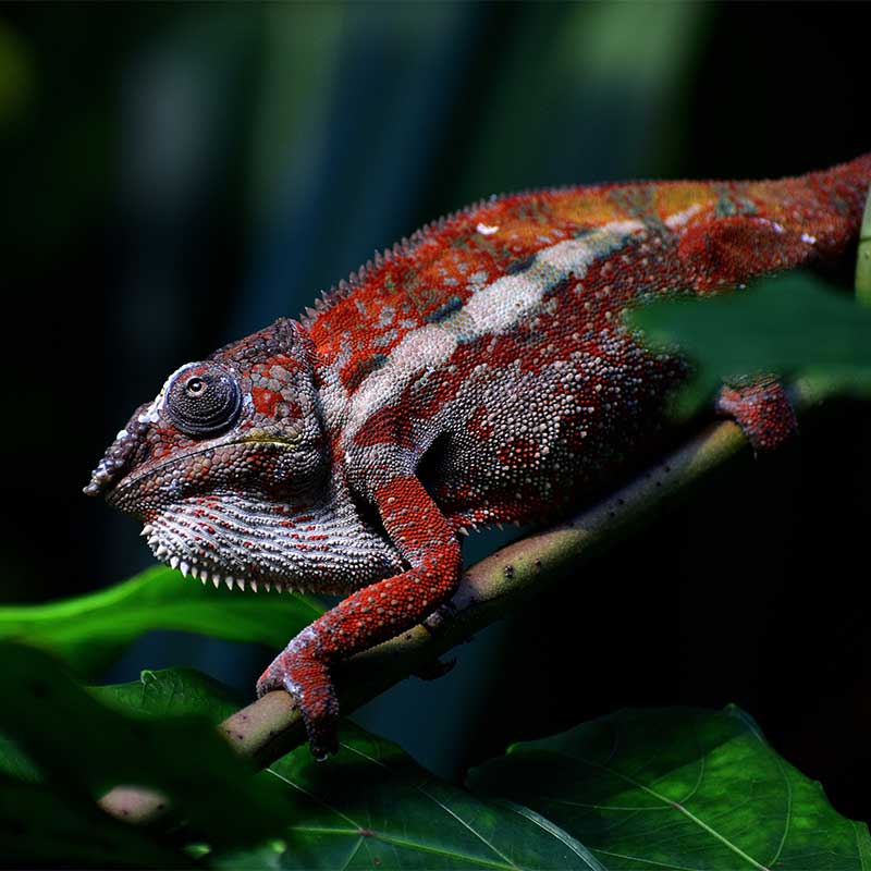
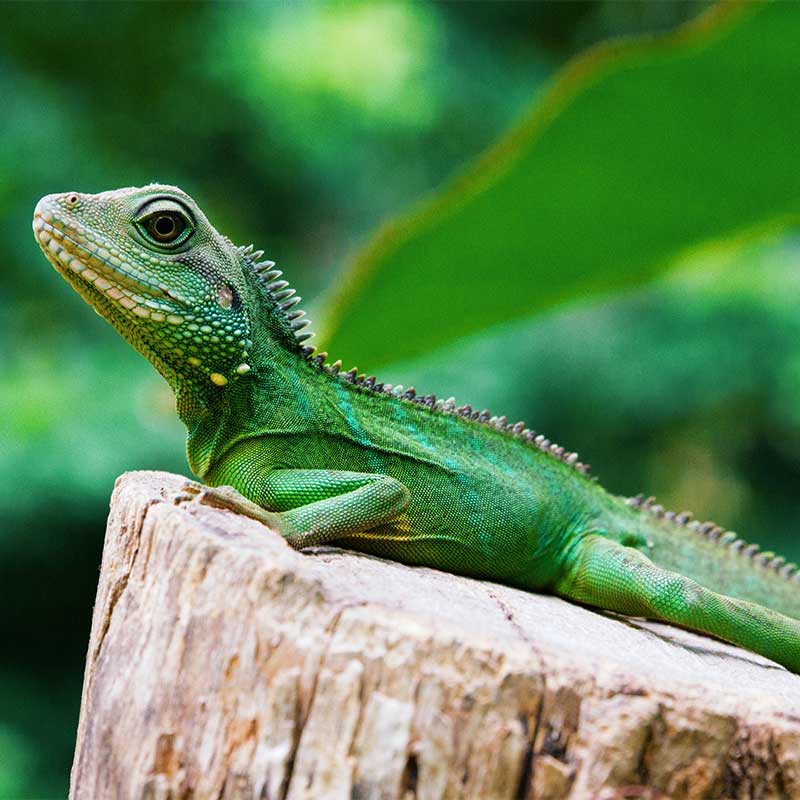
Renowned for its exceptional biodiversity, Nagarahole National Park provides a sanctuary for a diverse array of plant and animal life, including several species facing conservation challenges. Among the prominent inhabitants you might encounter are the majestic Bengal Tiger, the grand Indian Elephant, the robust Indian Bison (Gaur), the elusive Leopard, the distinctive Sloth Bear, the unique Four-Horned Antelope, and the social Indian Wild Dog (Dhole). Beyond these iconic creatures, the park is also home to numerous species of deer, various primates, a rich variety of reptiles, and a spectacular array of avian life, making it a birdwatcher's paradise.
Nagarahole's Journey Through Time
The history of Nagarahole National Park as a protected area dates back to 1955. Initially, approximately 285 square kilometers of forestland under the then Coorg state were designated as a 'Wildlife Sanctuary'. Significant expansion occurred in 1983 when the state government elevated its status to a 'National Park', extending its area to around 571.55 square kilometers. Further recognition came in 1986, as Nagarahole, alongside Bandipur Tiger Reserve, became an integral part of the expansive 'Nilgiri Biosphere Reserve'.
In 2000, Nagarahole National Park joined 'Project Elephant', a testament to its thriving elephant population, and was simultaneously established as a component of the 'Mysore Elephant Reserve'. Its commitment to conservation deepened in 2003 with its inclusion under 'Project Tiger', effectively making it an extension of Bandipur's tiger conservation efforts. Nagarahole gained independent 'Tiger Reserve' status in 2007, with a core/critical tiger habitat of approximately 643.392 sq. km. The reserve's administrative boundary was further expanded in 2012 by the Government of Karnataka, adding a 204.589 square kilometer buffer zone, bringing the total protected area to 848 sq. km.
Nagarahole at a Glance
Designated as India's 37th Tiger Reserve in 1999, Nagarahole National Park forms a vital part of the Nilgiri Biosphere Reserve. It's bordered by the Brahmagiri Mountains of the Western Ghats and is characterized by its abundant teak and sandalwood trees. Located at latitudes 12°15'37.69" N and longitudes 76°17'34.4" E, the park spans an impressive 847.981 sq. km. As a cornerstone of conservation under both Project Tiger and Project Elephant, it plays a crucial role in protecting India's diverse wildlife. Its adjacency to Bandipur, Mudumalai, and Wayanad Wildlife Sanctuaries creates one of Southern India's largest continuous protected areas.
Remarkably, Nagarahole boasts one of the country's highest tiger densities, with an estimated 125 individual tigers. This thriving ecosystem supports substantial populations of both herbivores and carnivores, including Leopards, Tigers, Dholes (Asiatic Wild Dogs), Gaurs (Indian Bison), Elephants, Sambar, Chital, Wild Boar, Barking Deer, Four-Horned Antelope, South-Western Langur, and many other fascinating species.
The Kabini River, the park's largest waterway, gracefully bisects the landscape and was dammed in 1974 for an irrigation project. Consequently, both the Kabini and Taraka Rivers contribute significantly to the park's aquatic resources, particularly towards its western and southeastern regions. In addition to these major rivers, a network of streams and rivulets further nourishes the park's diverse habitats.
Nagarahole is recognized for its high-density tiger population, standing among parks like Corbett and Kaziranga. Its breathtaking landscapes, featuring meandering streams and lush jungles, consistently captivate wildlife enthusiasts and nature lovers alike. Birdwatchers, in particular, are drawn to Nagarahole due to its spectacular diversity of bird species.
Conservation Initiatives and Ecotourism
Protecting Nagarahole's Future
The overarching goal of various project initiatives within Nagarahole National Park is to safeguard its Critical Tiger Habitat. This ensures a healthy and self-sustaining population of tigers, along with their co-predators and prey species, can thrive undisturbed.
Sustainable Exploration
Ecotourism represents a significant and evolving facet of the tourism industry, distinct from conventional 'mass tourism'. In Nagarahole Tiger Reserve, it's practiced with a strong emphasis on sustainability, equity, and community involvement, aiming to uplift the livelihoods of local communities residing on the reserve's periphery. Ecotourism activities are strategically conducted in two designated zones: the Nagarahole Wildlife Range and the Antharasanthe Wildlife Range.
Best Time to Experience Nagarahole
The ideal period to visit Nagarahole Tiger Reserve is generally from October to May. While Nagarahole maintains a tropical climate throughout the year, making it accessible at any time, the monsoon season is characterized by heavy rainfall and is typically advisable to avoid for optimal wildlife viewing and exploration.
The Geography of Nagarahole
Nagarahole National Park, an integral part of the Nilgiri Biosphere Reserve, is one of the largest and oldest protected areas. It is cradled by the Brahmagiri Mountains of the Western Ghats, boasting rich forests of teak and sandalwood. Located at approximately 12°15'37.69" N latitude and 76°17'34.4" E longitude, it spans an area of 847.981 sq. km. Its proximity to Bandipur National Park, Mudumalai National Park, and Wayanad Wildlife Sanctuary collectively forms the most extensive protected area in Southern India. The park features expansive flat grounds, often swampy and less densely vegetated, locally known as ‘Hadlus’. The Kabini River acts as a natural boundary, separating Nagarahole from Bandipur Tiger Reserve. During peak summer months, the fertile banks of the Kabini backwaters become a magnet for a large concentration of elephants and tigers. These ecosystems are vital, with tigers and elephants serving as flagship and umbrella species crucial for conserving the entire local biodiversity. Situated at the transition point between the Western Ghats and the Deccan Plateau, Nagarahole is home to bird species characteristic of both regions. The Varied forest types like Semi-Evergreen, Dry Deciduous, Moist Deciduous, and Thorny Scrub Forests along with the presence of the Kabini and Taraka backwaters add to the species diversity thus, it is an Important Bird Area in South India.
From a geographical perspective, Nagarahole lies within one of India's richest biodiversity zones: the ‘5 B Western Ghats Mountains Biogeography Zone’. It is interconnected with the Brahmagiri Wildlife Sanctuary via the narrow Kutta Corridor, bounded by the Wayanad Wildlife Sanctuary to the southwest. Towards the Western parts of the Kodagu district and crop mosaic towards the Eastern parts, the land cover around the protected area includes large tracts of forests and coffee plantations. Nagarahole is diversified by several streams like Kabini, Taraka, Nagarahole, Sarathi, and Lakshmanthirtha which further expand and become tributaries of two major rivers namely Kabini and Lakshmanthirtha which further joins the river Cauvery. The Rivers in Nagarahole Tiger Reserve act as a lifeline for local farmers living in the fringe areas. Water harvested from these streams and rivers also irrigates large areas in other districts of Karnataka & Tamil Nadu, which is critical to the entire region's agrarian development and economy. It is considered one of the ecosystem services of the Nagarahole tiger reserve, as well as a tangible outcome of tiger conservation in the Western Ghats.